
Today, Indigenous Land Councils across Australia are using GPS, photogrammetry, and camera-equipped drones to map sacred sites. These efforts—essential for heritage preservation, land rights, and education—are often slow, expensive, and bottlenecked by availability of specialists and external contractors.
But what if this work could be crowdsourced to the community?
What if the digital custodians of Country were the Traditional Owners themselves?
From Ceremony to Data Node
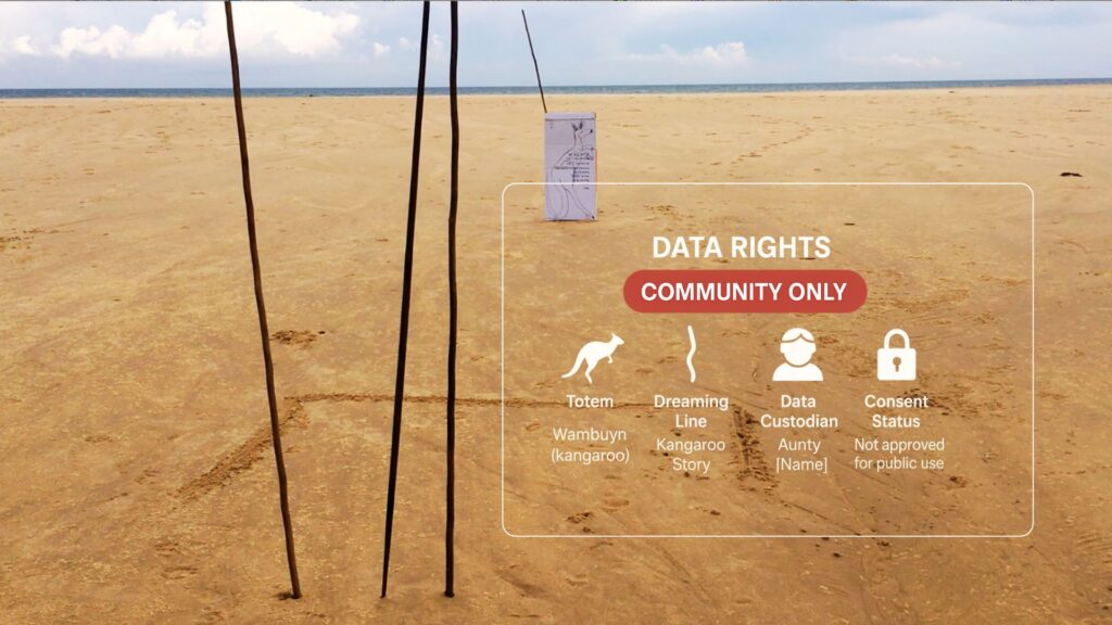
In our early Vloggi fieldwork on Biripi Country (Saltwater National Park), we witnessed Elders marking kangaroo Dreaming lines in the sand with simple sticks—symbolising Wambuyn, a sacred totem. These weren’t decorative. They were spiritual signposts.
In today’s digital twin frameworks, those sticks become data nodes:
- Tagged with totemic meaning
- Embedded with custodial metadata
- Reviewed and approved before external access is permitted
That’s Indigenous data sovereignty in action.
The Tools Exist — Let’s Decentralise The
Modern mobile phones now come with:
- Triple camera arrays for real-time photogrammetry
- LIDAR sensors for elevation and depth capture
- 5G + Starlink connectivity even in remote bush
If you equip a community with these tools and combine them with culturally-governed digital workflows, every Elder, youth, or ranger becomes a mobile mapper of Country.
All footage can be:
- Geo-tagged and catalogued
- Logged with consent metadata
- Reviewed through a cultural authority lens
Approved stories and markers are woven into digital twins—living archives of Country that honour the past while preparing for the future.
Consent Is the Core
Any footage or data gathered is locked until released by Elders. Not everything is for public view. Digital twins must reflect cultural boundaries—not just geographical ones.
The aim isn’t to digitise culture for mass consumption.
The aim is to digitise control—so that First Nations peoples determine what’s shared, when, and with whom.
This is not just mapping. It’s memory.
For First Nations tourism, land rights, ecological monitoring, or cultural education, digital twins offer a powerful bridge between ancient practice and modern precision. It’s not tech for tech’s sake. It’s ceremony in code.
If your Land Council, language group, or ranger team wants to explore this, reach out. We’re building these tools for—and with—you.
Originally posted 2026-02-27 13:21:22.